


 There are just about as many layers of history in Savernake Forest as there are rings in the trunks of some of its older trees. And one of the most recent layers is again attracting the interest of local archaeologists and historians – Savernake Forest’s role in the Second World War.
A full-scale survey will start soon using the latest data to produce as complete as possible audit of Savernake’s wartime buildings
 To most people walking through the forest the humps of earth (photo left) look like nothing more than part of a very junior BMX track. To the experts they are evidence of wartime buildings.
The measurement of the space between the humps and the remains of walls beneath the grass, prove they were the ends of a set of army garages.
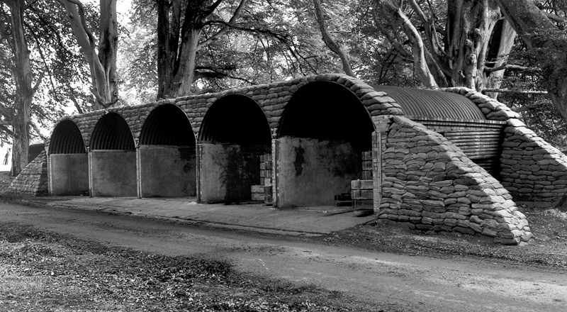 Unlike the garages in the photograph (right), some garages were eventually given earth ramps at each end to protect the end walls from possible explosive blast.
Marlborough News Online went out last week to see a team of three experts doing some preparatory work for the survey.
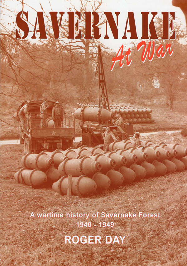
Roger Day is the historian of the forest’s role in wartime and wrote the ground-breaking book: Savernake at War. He was born in Marlborough, brought up in Ramsbury (and has investigated the history of Ramsbury’s wartime airfield) and now lives in Hungerford.
Dan Miles Is an archaeologist working for English Heritage and is an active members the Wiltshire Archaeological and Natural History Society’s Archaeology Field Group.
And Iain Fry is a history enthusiast, who was brought up in Marlborough, now lives in Swindon and has been involved in archaeological projects on the First World War’s Western Front.
The group want to complete the survey before any more of the buildings are lost for ever: “Second World War sites in the forest are just as important as older remains.”
This team uses data from old and new Ordnance Survey maps, wartime aerial photographs and a more recent LIDAR survey (a remote sensing technology using lasers and reflected light.)
Overlaying all this data they can see where the remains of buildings, gun pits and even smaller positions, should be found – and where the survey should be concentrated.

There are other signs of the forest’s military occupation. Archaeologists call them arborglyphs – they are names and dates with sometimes even unit information carved into tree bark by bored and often homesick soldiers.
Often the tree will have grown so much that the lettering is spread out and unreadable. But many survive and provide useful evidence.
Savernake – including Tottenham House – was taken over by the War Office and much of the forest became a vast ammunition dump. And ammunition stores spread out along the roads around the forest.
Within the forest miles of concrete and tarmac roads were laid down and a camp was established at Iron Gates (now the main entrance to Grand Avenue off the A4.) Many of the troops – especially in the build-up to D-Day – were American, including many black soldiers.
 Roger Day’s book tells the story of the ammunition explosions of 1945 and 1946. And the sad tale of the murder by an American soldier in 1943 of 19-year-old June Lay who worked as an assistant cook at Savernake Hospital.
Among recent finds made during preparation for the survey are the remains of an army sawmill which was built in 1940 and run until 1943 by a ‘Forestry Company’ of the New Zealand Army who were lodged in Burbage.
This new survey, which has the Forestry Commission full support, will begin in about three weeks. But the team are asking anyone who knows about the second world war buildings in the forest to get in touch with them.
People may have stumbled across something while out walking or they may remember something from their childhood when they rode their bikes along the paths or played hide and seek in the forest.
Please contact the team at savernakeww2project@outlook.com