


The weather has managed to do what the combined might of Thames Water, Giga fibre installers, Gas contractors and Wiltshire Council have thankfully never managed: closed roads and made it almost impossible to navigate around the town. And forced residents to evacuate their homes. Marlborough at a standstill.
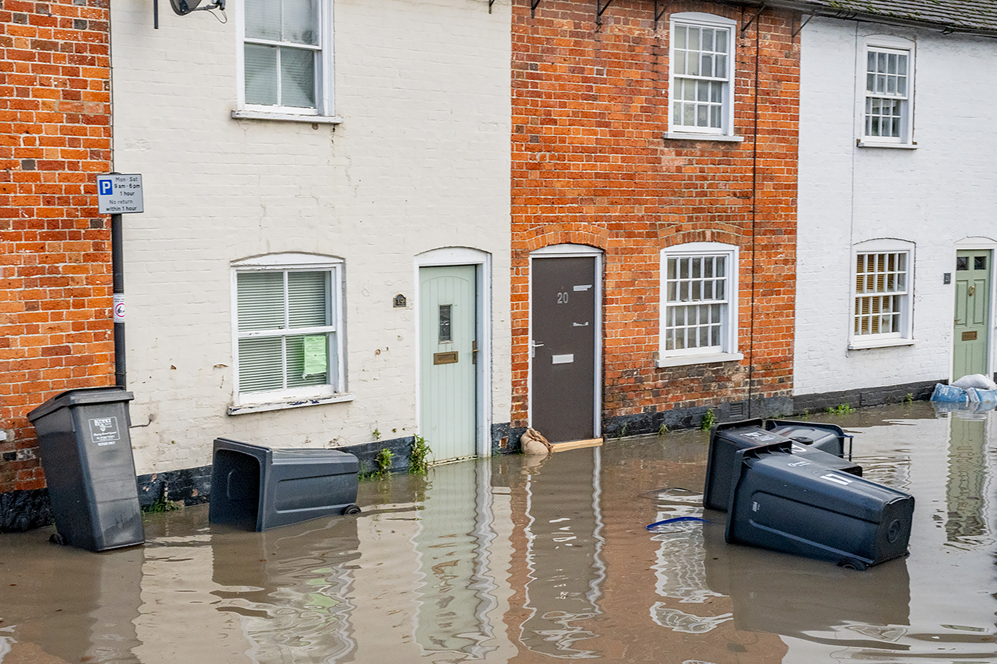
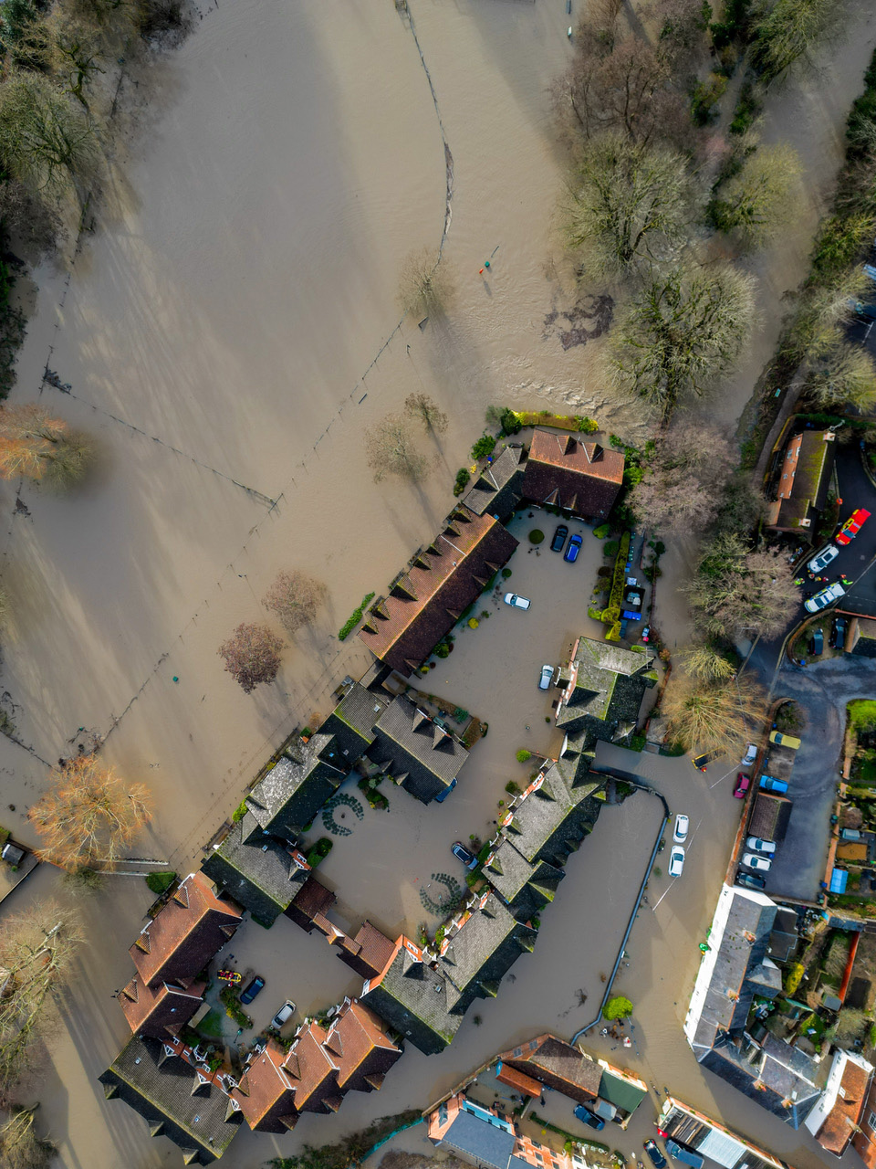
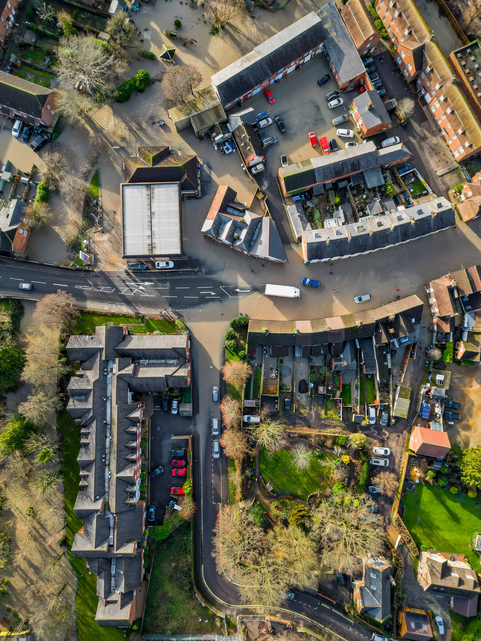
Later in the afternoon residents of Town Mill had to leave their homes, as did residents from the ground floor of Castle Court, the independent living retirement complex on the Pewsey Road . The Parade was flooded completely. And even by 5pm the whole area was still under water and closed off.
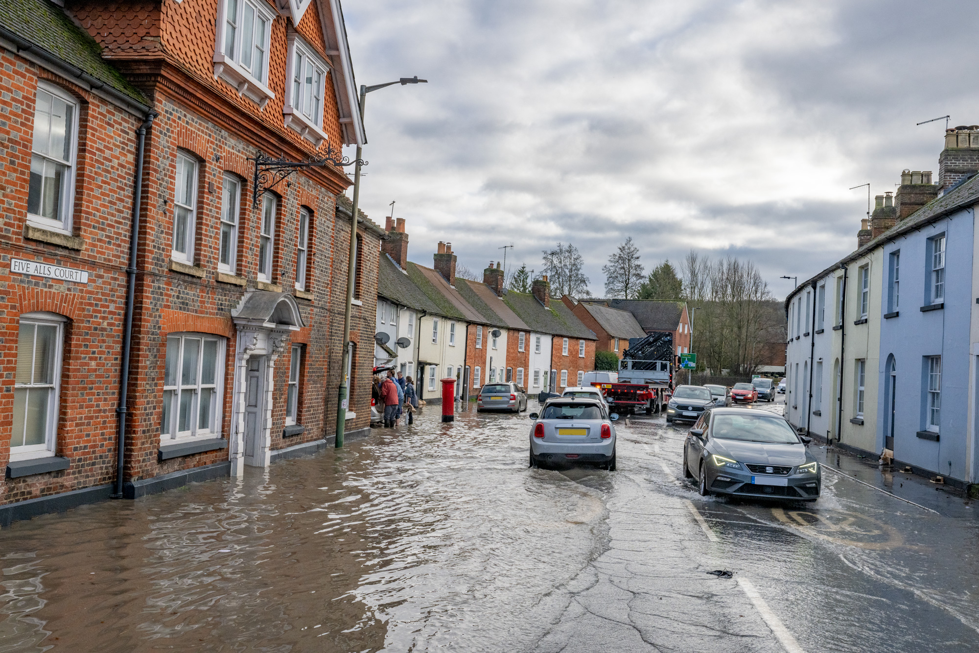
London Road was under water between Bridge Garage and the Wye House mini roundabout and closed. Long time residents reckoned that this was far worse than the last time there was flooding in town, twenty-one years ago in 2003.
Wiltshire (and Town) Councillor Jane Davies told Marlborough.news: The Marlborough flood today has been an unpleasant surprise and my heart goes out to those residents affected It has been heartening to see the police, Wiltshire Council and Marlborough Town Council working together to support residents who have had to temporarily leave their homes whilst the flood subsides and the subsequent cleanup takes place.
Devizes MP Danny Kruger visited Marlborough this evening and spent a while with those evacuated earlier. He tweeted (‘X’d?):
I spent this evening in Marlborough Town Hall talking to residents evacuated after the worst floods here in living memory. So impressed with the resilience and good spirits of everyone – heard nothing but good words for @wiltscouncil @MTCwilts @DWFireRescue “We just get on with it” was the general mood – huge respect to all the council staff and volunteers who stepped up to offer help, food, beds for the night. I gave a lift to the last lady going to stay with friends. I’m in touch with the Environment Agency – I hope the waters fall quickly and everyone gets back home as soon as possible.
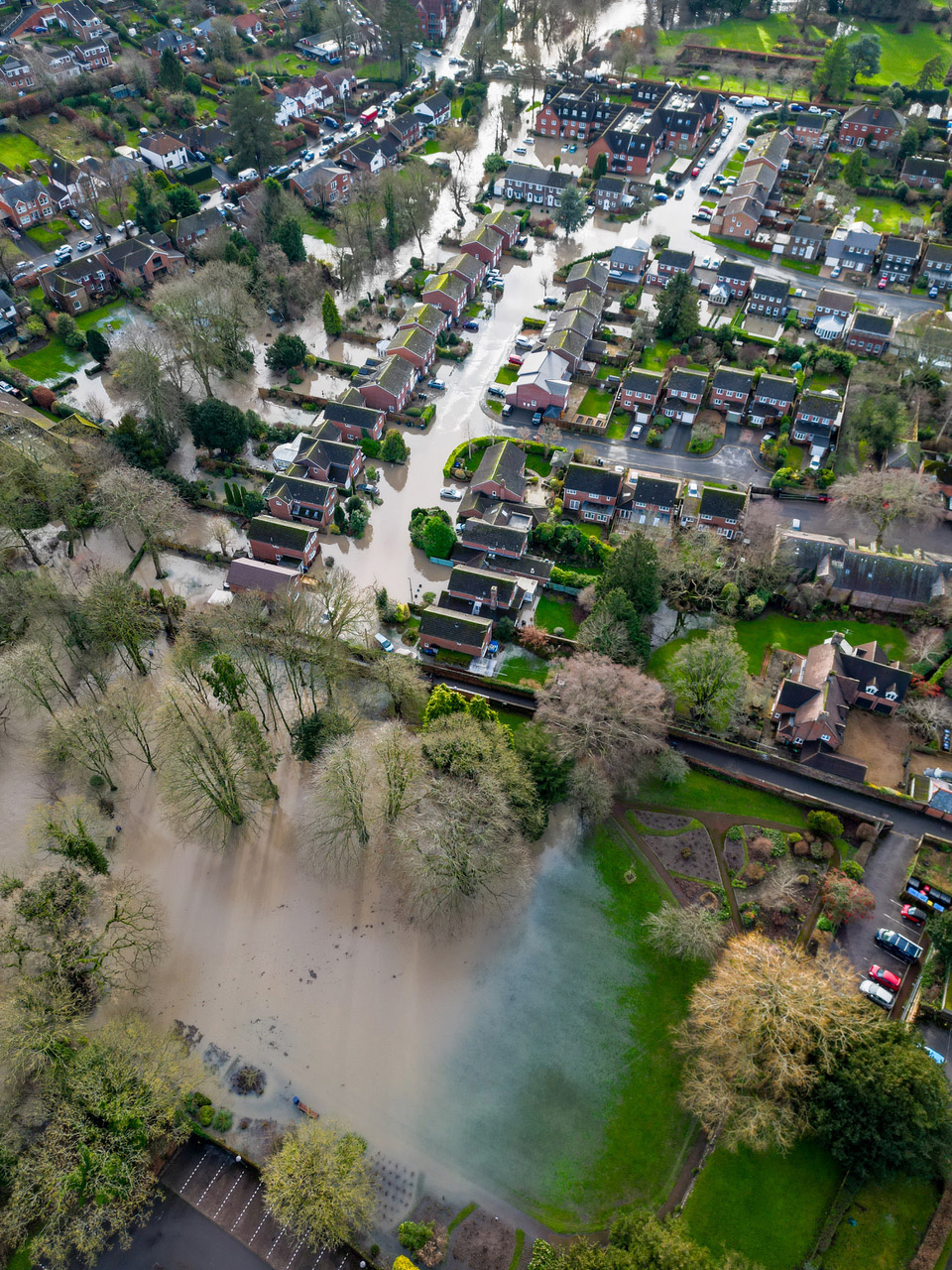
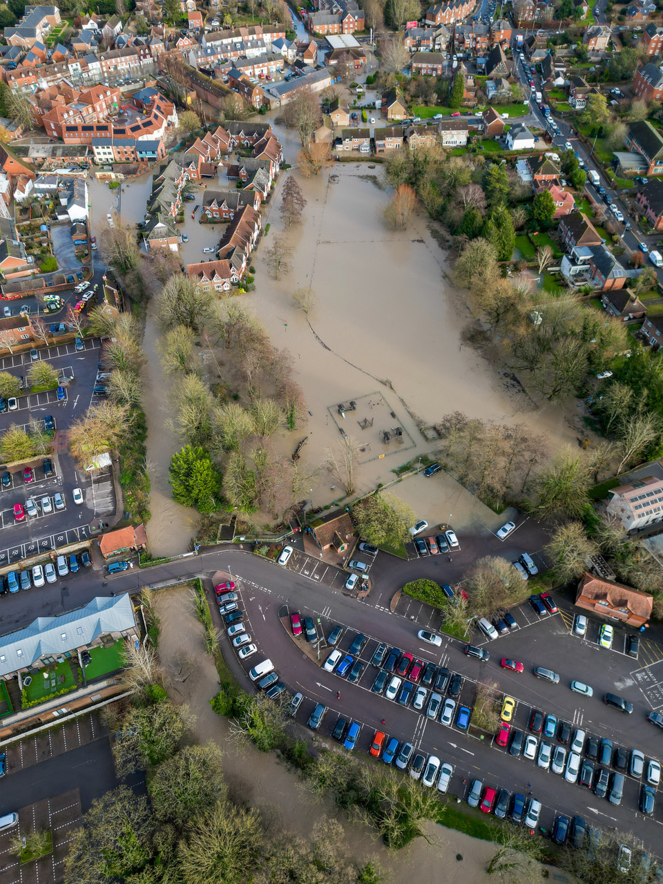
Below are a series of aerial pics of Marlborough, taken by Pete Davies of Marlborough Photo Services which show the extent and detail of the flooding. Taken this afternoon between 3 and 4pm when the flooding was at its height. Click any to enlarge:


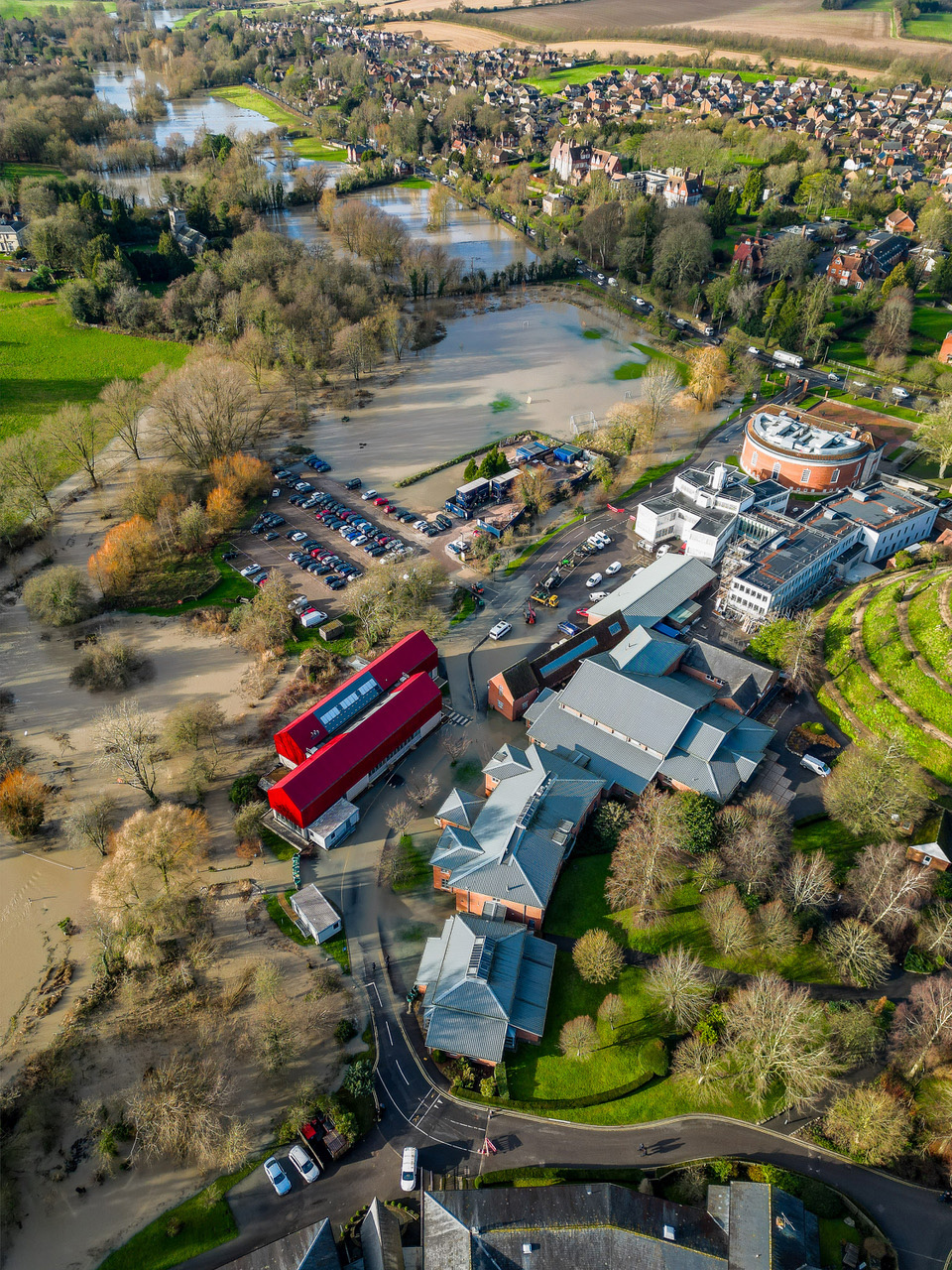
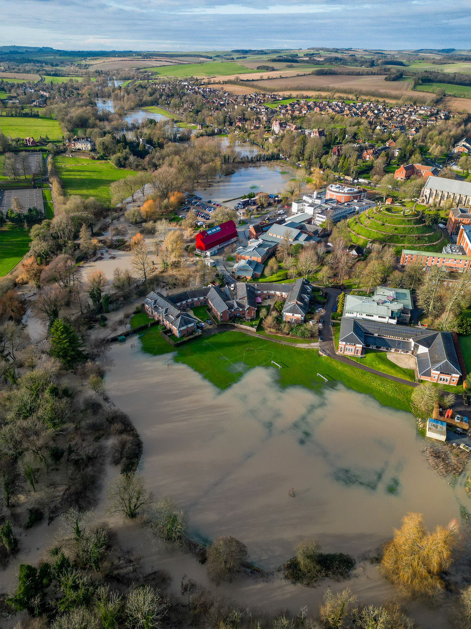
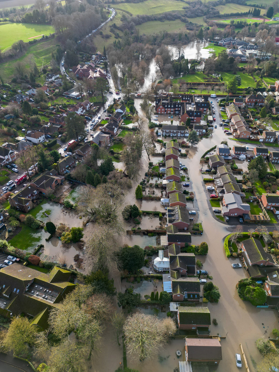
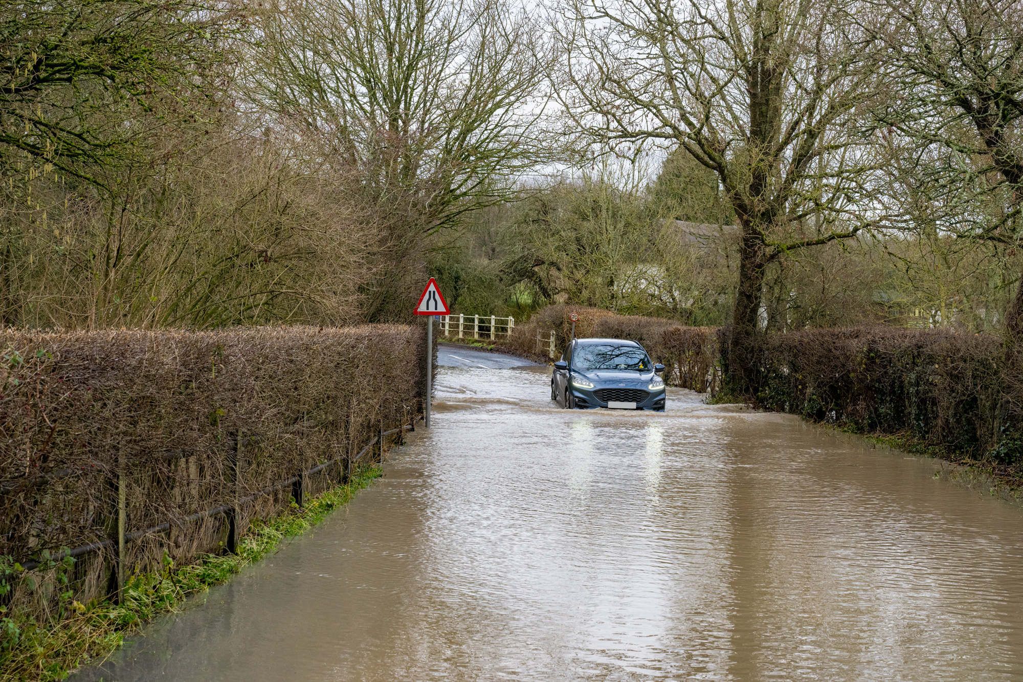
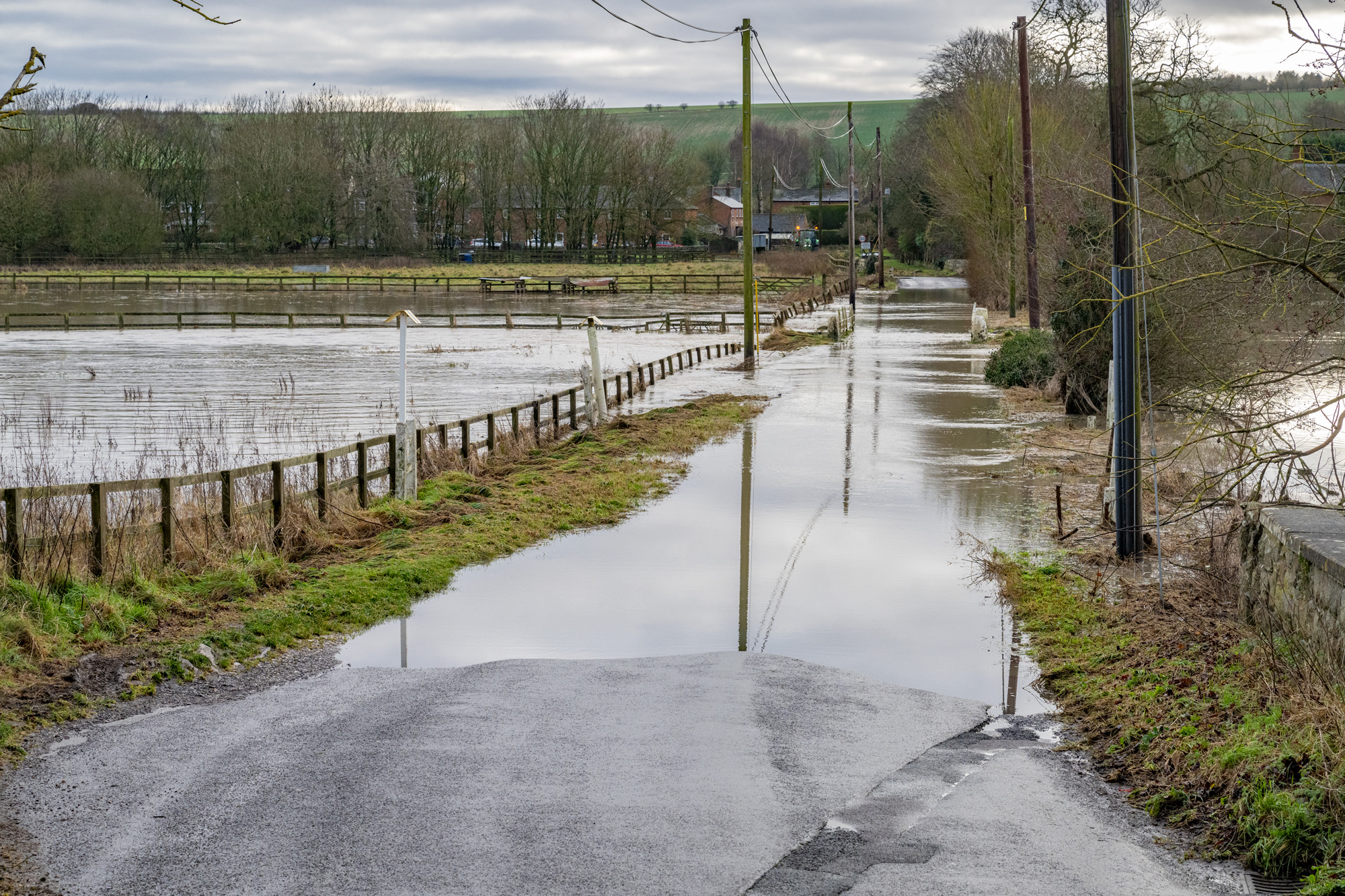
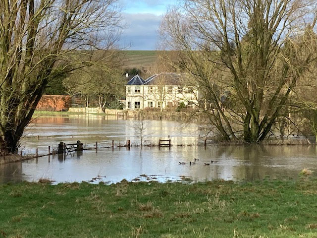
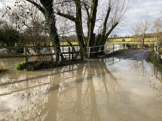
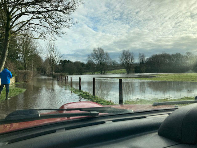
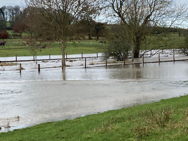
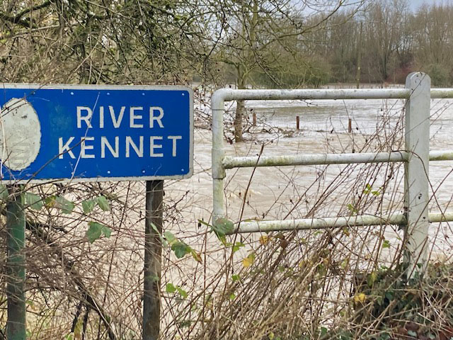
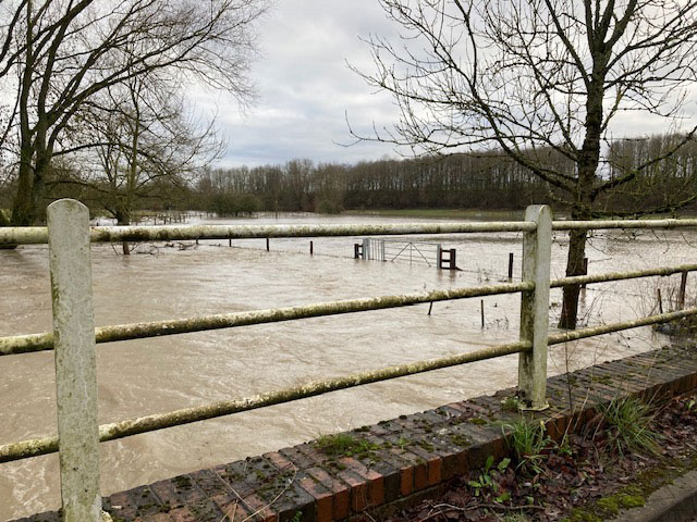
The Kennet flooded all surrounding areas further upstream. The College Water Meadows were exactly that, water meadows, and the roads through Lockeridge and West Overton were under water and only passable safely at times by larger 4×4 vehicles or tractors:
 Hope and Homes for Children Carol Concert raises over £7K
