


 This monthly report on Marlborough’s weather begins with photographs of a very strange cloud formation captured over Westonbirt.
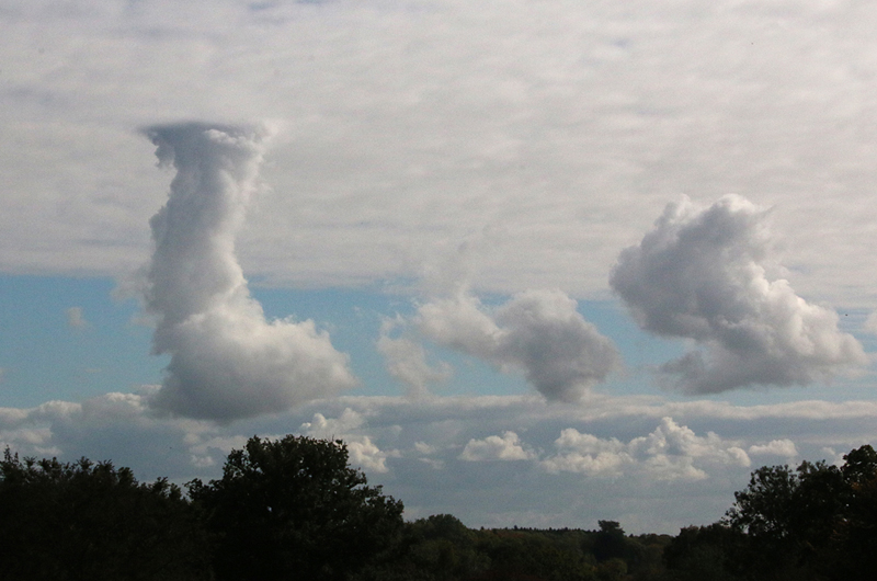
Cloud-watchers often class October as the best time of the year to see interesting cloud formations. On Friday, October 9, while I was visiting the Westonbirt Arboretum, I took two most fascinating images of a cloud formation that was quite unlike any other cloud in the sky that morning.
I consulted the meteorologist colleagues who receive my monthly figures as part of their national data gathering, and they were unsure of the cause, but produced two possible scenarios.
It might have been caused by a local heat source somewhere near the base of the cloud or it might also have been due to conditional instability because of a locally more pronounced release of latent heat – perhaps moister air over a reservoir/river.
The unusual pillar shaped cloud spread out when it reached the upper blanket of cloud.
 In Marlborough, the first week in October brought very mild weather with maximum temperatures some 2 – 3C above the mean, but with the arrival of winds from a northerly direction on the ninth, daytime temperatures took a tumble.
Towards the end of the month the situation was reversed when warm, moist air brought to us on a southerly flow, returned daytime maxima to normal and gave us several warm nights.
The warmest day occurred on the sixth with a high of 17.9C and a minimum overnight of 13.8C, close to the mean daytime figure.
However, there were many very cool nights when the thermometer dropped to low single figures with the coldest just 0.7C on the morning of the twenty-fifth. The mean temperature for October was 0.4C below the long-term average, almost entirely due to cooler nights.
This was another October when no air frosts occurred, unlike the 1980s and 1990s, and was the third consecutive frost-free October. The hardest October grass frost occurred on the thirtieth with a minimum of 5.1C.
An analysis of the occurrence of air frost in autumn over the past 32 years produces an interesting result. A more detailed report will follow later in November after we experience this autumn’s first air frost.
There were twenty totally dry days in the month with total rainfall amounting to 65.3mm, which is 24mm below the 32-year average and the driest for four years.
The extreme years were in 2003 with only 36.8mm and the following year of 2004 with 159.5mm. The fifth of October was notable for the almost continuous rain all day producing a total of 21.4mm.
The total rainfall for the ten months of 2015 is 594mm. Last year was notable in that it brought us the wettest January to October total of 920.6mm, which contrasts with the driest January to October of 1996 that produced just 409mm.
On the first two days of the month we enjoyed 10.2 hours and 9.8 hours of strong sunshine, but overcast days in the latter half of October produced ten days with no daily strong sunshine. However, the solar energy total for the month was the highest since 2011.
There were four mornings at the start of the month when fog occurred – the densest was on the fourth with visibility down to 50 metres.
